Share this Page on Facebook, Twitter or by Email:

Saturday, January 14, 2012

Subic Bay

Zambales, Luzon
Subic Bay Freeport Zone (SBF), which is known simply as Subic Bay, is the Philippines' first successful case of a military base converted through volunteerism into a tax- and duty-free zone similar to Hong Kong and Singapore, operated and managed by the Subic Bay Metropolitan Authority or SBMA. It covers the fenced area of the former U.S. Naval Base Subic Bay located in the southwest of Luzon Island in the Philippines and surrounded by the municipalities of Subic and Olongapo City in Zambales and Hermosa and Morong in Bataan, in concurrence of these municipalities' Sangguniang Bayan, pursuant to Section 12 of RA 7227. The harbor faces the Zambales Mountain Range to the west and the Subic Bay opening to the South China Sea. It is northwest of the Bataan Peninsula and southwest of Zambales Province.

SBF is 110 kilometers north of Manila. Manila Bay and the Bataan Peninsula separate SBF from Manila. The mountain ranges around the Subic Bay area and the deep natural harbor provide excellent and protected anchorage. In addition, these features make SBF naturally sheltered from typhoons as well as from the effects of an eruption of nearby Mt. Pinatubo.

Subic Bay Freeport is in Region III (or Central Luzon Region) of the Philippines. It is one of the points in the growth triangle (and an engine for economic development) in the region. SBF is a supplier of services and products for the Central Luzon Development Program, a regional growth area composed of the provinces of Bulacan, Nueva Ecija, Tarlac, Pampanga, Bataan, and Zambales.

Subic Bay is surrounded by the town of Subic and Olongapo City, both in the province of Zambales. Development of Olongapo City was largely tied to the presence of the United States Navy base at Subic Bay, once the largest U.S. military naval base in Asia. An arsenal and ship-repair facility was established at Subic Bay in 1885 by the then colonial power, Spain. Following the Spanish-American war, Subic Bay became a U.S. Navy and Marine base, and grew to be a major facility. Until 1991, it was the base of the United States 7th Fleet.

In early 1991, after the collapse of protracted negotiations, the Philippine Senate rejected terms for renewal of the lease of the base. The US Navy was already in the process of downsizing its Subic operations in June 1991, when Mount Pinatubo erupted. One of the largest volcanic eruptions in the last 100 years, it covered the Navy Base in volcanic ash and collapsed a significant number of structures. The last ship, USS Belleau Wood, left on November 24, 1992.

Surprisingly the departure of the Americans did not spell doom. Subic Bay was converted into a commercial zone largely through the efforts of some 8,000 residents of nearby Olongapo City, under the leadership of their mayor, Richard Gordon, who volunteered to protect and preserve 8 billion dollars worth of facilities and property from looting and destruction. Subic has since been transformed and became a model for bases conversion into commercial use after the Cold War with blue chip companies like Coastal Petroleum, and Fed Ex pumping in over $3 billion of investments creating 70,000 jobs in the free port's first four years. It was host to the 4th APEC Leaders' Summit on November 24, 1996 and . FedEx's Asia-Pacific hub, Asia-One, was also located in Subic Bay for almost ten years.
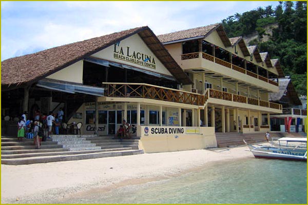
In addition to commercial use, Subic Bay is also a popular destination for weekend visitors from Metro Manila. Attractions include several beaches, an underwater aquarium, jungle survival tours, racing and duty-free shopping centers.

Subic Bay, the Philippines' first free port (see, Port of Subic), continues to be one of the country's major economic engines with more than 700 investment projects, including the 4th largest shipbuilding facility in the world (Hanjin Heavy Industries and Construction (HHIC)). Currently upgrading its port facilities through the Subic Bay Port Development Project and forging ties with the Clark Special Economic Zone in Angeles City, Pampanga to form the Subic-Clark Corridor via the 45-kilometer Subic-Clark-Tarlac Expressway, these once bastions of western military might are now being positioned to become the most competitive international service and logistics center in Southeast Asia.

As a destination, Subic Bay has maintained its allure that once charmed US servicemen and their families. Its community continues to preserve and protect the bay, its surrounding forests and its flora and fauna. Interesting sights to see are its resident eco-tourism theme parks, the Ocean Adventure, the country's only open-sea marine park, Zoobic Safari, and the Pamulaklakin Nature Park which is home to the indigenous Aetas who once trained the U.S. Navy jungle survival tactics.

Friday, January 13, 2012

San Juanico Bridge

Western Samar-Northern Leyte, Visayas


The San Juanico Bridge, part of the Pan-Philippine Highway, stretches from Samar to Leyte across the San Juanico Strait in the Philippines. Its longest length is a steel girder viaduct built on reinforced concrete piers, and its main span is of an arch-shaped truss design. With a total length of 2.16 kilometers (1.34 mi), it is the longest bridge in the Philippines spanning a body of seawater. It is considered one of the most beautifully designed bridges in Philippines. The bridge has 43 spans and medium size boats can pass beneath its large main arch the top of which rises 41 meters above the sea. Construction commenced in 1969 over San Juanico Strait from Cabalawan, Tacloban City to the municipality of Santa Rita, Samar, with completion in 1973.


The bridge was then named as Marcos Bridge after the era that was built upon. It was said to have been presented as a Gift and "Testimonial of Love" by the Philippine President Ferdinand Marcos to the first lady, Imelda, a native of Leyte.
The Candaba Viaduct of Pampanga which forms part of the North Luzon Expressway is longer, but being a land bridge crossing a few streams, ponds, and a swamp which usually fills in rainy weather, is less impressive.
Connecting Tacloban City on the Leyte side and Santa Rita town on the Samar side, it offers many picturesque views, especially of the San Juanico Strait with its thousand whirlpools as well as the islets of the province. It is approximately 10 minutes from downtown Tacloban City and is accessible by passenger jeepney, bus, motorcab or private vehicle.


Construction of the 21.9 million-dollar bridge was contracted to the Construction and Development Corporation of the Philippines (now the Philippine National Construction Corporation), which together with Japanese engineers conducted studies and designed the actual project.

Tuesday, January 10, 2012

Boracay

Aklan, Visayas


Boracay is an island of the Philippines located approximately 315 km (196 mi) south of Manila and 2 km off the northwest tip of Panay Island in the Western Visayas region of the Philippines. Boracay Island and its beaches have received awards numerous times. Boracay was awarded in the "Travelers' Choice 2011" by TripAdvisor as the second best beach (out of 25) in the world. Boracay made a debut appearance on the Top 10 Islands list in the Travel + Leisure travel magazine World's Best Awards 2011, ranking fourth.
The island comprises the barangays of Manoc-Manoc, Balabag, and Yapak (3 of the 17 barangays which make up the municipality of Malay), and is under the administrative control of the Philippine Tourism Authority in coordination with the Provincial Government of Aklan.
Boracay was originally home to the Ati tribe. Boracay is part of Aklan Province, which became an independent province on April 25, 1956.
In the late 1800s the island was "discovered" by Sofia Gonzales Tirol. She and her husband Lamberto Hontiveros Tirol, a town judge on nearby Panay island, took ownership of substantial properties and began to clear and develop the island.
Decades ago, Boracay Island was an almost possessively guarded secret so that only a few knew of its existence. Tourism only began to develop in the 1970s, after the movie 'Too Late the Hero' was filmed on locations in Boracay and Caticlan.
In the 1980s, the island became popular with backpackers. Since then, Boracay has gradually become a cosmopolitan tourism destination and, in the 21st century, has become one of the major tourist destinations in the Philippines.
Boracay Island is located off the northwest corner of Panay Island, and belongs to the Western Visayas island-group, or Region VI, of the Philippines. The island is approximately seven kilometers long, dog-bone shaped with the narrowest spot being less than one kilometer wide, and has a total land area of 10.32 square kilometers.
South-facing Cagban Beach is located across a small strait from the jetty port at Caticlan on Panay island, and the Cagban jetty port serves as Boracay's main entry and exit point during most of the year. When wind and sea conditions dictate, east-facing Tambisaan Beach serves as an alternative entry and exit point.
Boracay's two primary tourism beaches, White Beach and Bulabog Beach, are located on opposite sides of the island's narrow central area. White Beach faces westward and Bulabog Beach faces eastward. The island also has several other beaches.
White Beach is the main tourism beach. It is about four kilometers long and is lined with resorts, hotels, lodging houses, restaurants, and other tourism-related businesses. In the central portion, for about two kilometers, there is a footpath known as the Beachfront Path separating the beach itself from the establishments located along it. North and south of the Beachfront Path, beachfront establishments do literally front along the beach itself. Several roads and paths connect the Beachfront Path with Boracay's Main Road, a vehicular road which runs the length of the island. At the extreme northern end of White Beach, a footpath runs around the headland there and connects White Beach with Diniwid Beach.
Bulabog Beach, across the island from White Beach, is the second most popular tourism beach on the island and Boracay's main windsurfing and kiteboarding area.
Boracay is divided, for land use and conservation purposes, into 400 hectares of preserved forestland and 628.96 hectares of agricultural land.
Leisure activities available on or near Boracay include scuba diving, snorkeling, windsurfing, kiteboarding, cliff diving, and beach relaxation.
Boracay is the site of a 18-hole par 72 golf course designed by Graham Marsh. In addition, as of 2010, Boracay has in excess of 350 beach resorts offering more than 2,000 rooms ranging in quality from five-star to budget accommodation.

Brookes Point

Palawan, Luzon


Brookes Point is a 1st class municipality in the province of Palawan, Philippines.
Named after Sir James Brooke, the municipality has become famous for its promotion of ecotourism. It has also earned the distinction of being the original home of the biggest pearl in the world, known as the Pearl of Lao Tzu or the Pearl of Allah; found in its waters on May 7, 1934.
The name Brookes Point comes from an Englishman Sir James Brooke, first white Rajah of Sarawak and founder of the Brooke Dynasty. It is believed that during one of his voyages, he landed on the tip of an island with a long narrow stretch of land inhabited by native Palaweños and Muslims under the Sultanate of Sulu. Establishing trade and gaining the trust of the people, the name Brooke was so imprinted in the minds of the people that when American scouts came to the land almost a century later, they named it Brooke's Point.
Brookes Point is bounded in the North by the Municipality of Sofronio Española, in the South by the Municipality of Bataraza, in the West by the Municipality of Jose Rizal, and in the East by the Sulu Sea.
Barangay Oring-Oring, located some 7 kms from Poblacion proper is the birthplace of the World’s Biggest Pearl; known throughout the world as the Pearl of Allah or the Pearl of Lau-Tzu, this 14.1-pound porcelaneous pearl was found by a native Moslem in the seas of Oring-Oring. Valued in 1984 at USD $42 million, the ownership of this unique pearl is still in dispute. What is clear, however, is its origins: Oring-Oring, Brookes Point.The clam that gave birth to this pearl can still be found in the possession of the heirs of Panglima Pisi, the original owner of the pearl.


Also in Oring-Oring, another Natural Wonder can be found: the Ocean Spring. A few meters from the shore, submerged in the Sulu Sea are freshwater water springs with clean, fresh potable water.Today, the two identified springs are protected by a well, and is still used by the natives as a source of drinking water.
Mainit Falls and Hot Water Springs can be found 10 kilometers from the town proper, approximately 30 minutes by car. The Mainit Waterfalls not only serve to irrigate nearby fields but also serve as a source of drinking water to the residents living around its vicinity. Although Palawan stands outside the Ring of Fire, hot springs flow a few meters from the waterfall. Its sulfuric waters have been known to attract the Trogonoptera Trojana, a species of butterflies that is endemic to Palawan.


Bakbakan falls, a 64-meter waterfall can also be found in Barangay Mainit. Between Barangays Aribungos and Ipilan, Sabsaban Falls, also a frequently-visited site, acts as a natural boundary between the two towns.
Brookes Port, believed to have been constructed by Sir James Brooke himself, is a historical landmark in Brookes Point. Today, owing to erosion and the constant movement of the tides, only a few stones can still be seen in place.
Brookes Lighthouse is also believed to have been built by the Englishman. The remnants of the original lighthouse tower are still visible, although the area is now occupied by a new lighthouse.
Addison Peak, locally known as Mount Maruyog, with a height of 1,024 meters above sea level, is the highest point in Brookes Point and offers a panoramic view of the town and its surroundings.
At the edge of the town, sharing its boundaries with the Municipalities of Brookes Point, Bataraza, Sofronio Espanola, Quezon and Jose Rizal is Mount Mantalingahan with an elevation of 2,085 meters above sea level. Mount Mantalingahan is part of a series of mountain ranges that effectively divide the whole of Palawan into the East and West Coast.
Brookes Point has a modern sea port that may accommodate commercial passenger and cargo ships. from Manila, and Mindanao, as well as numerous fishing vessels.

Monday, January 9, 2012

Loboc River

Bohol, Visayas


The Loboc River is a river on Bohol Island, the Philippines. It is one of the major tourist destinations of Bohol, local and foreigners alike. The winding river plays host to cruises on board of small bancas or floating restaurants. Visitors are treated to a vista of lush tropical vegetation such as nipa palms, coconut trees, banana groves, and bushes.
The river plays a significant role in the history of Loboc before the Spaniards established the town in 1602. The early inhabitants made homes along the river.
It was in early 1980s that the idea to promote the Loboc River as a tourist destination started.
A cruise along the river starts either from the Loay Bridge (in Loay) or at the Poblacion of Loboc. The Loay Bridge is 20 kilometers (12 mi) from Tagbilaran City while the Poblacion is about 25 kilometers (16 mi) away. Small motorized bancas can be chartered for a minimal fee. For those who want to eat while cruising, floating restaurants are available offering Filipino cuisine buffet and local delicacies that costs P280 per head or more.
With the tourism fever, the floating restaurants were envisioned providing tourists with a first class dining experience on board floating restaurants. The floating vessels are made up of a covered platform on top of two large outrigger boats which are joined together. The boats can accommodate up to 50 people.
Most of the floating restaurants treat their guests with Boholano songs played by in-boat bands during the cruise. The trip winds up the river and ends at the Busay Falls which is only one and a half meter at most. Here, the guests are treated to rondalla music by a local rondalla group housed under a floating cottage.
Local folks usually take a dip in the waters and enjoy bathing under the falls. Guests who have brought with them extra clothes are welcome to swim and bathe and experience the heady feeling of a refreshing swim in the river’s unpolluted waters.


Going to and from the Busay Falls, visitors are treated to a spectacle of children diving from a large coconut tree that is leaning out towards the river. One will feel a bit tense seeing the children climbing up the tree and then plunging towards the deep waters. From the looks of it, the part of the tree where the children usually dive from is more than 10 feet (3.0 m) from the river.
Along the way, one can see children swimming and people passing by in small bancas or canoes. Upstream, and located on the eastern bank of the river, the Nuts Huts Resort is seen. This resort is a favorite hang-out for bikers and hikers who prefer the peaceful and scenic surroundings of the river bank rather than the majestic allure of the sea.

Another area worth visiting is where wild chickens, turtles, and pythons are kept in captivity. On this trips, visitors are given the time to marvel at the surrounding landscape. After a while, the return trip starts. Since the trip is going downstream, it takes a shorter time for the boats to arrive at the starting point.

Puerto Galera

Oriental Mindoro, Luzon


Puerto Galera is the northwesternmost municipality in the province of Oriental Mindoro, Philippines. This coastal town is well known among tourists for its numerous pocket beaches and many snorkeling and Scuba diving spots. The area was designated a Man and Biosphere Reserve of UNESCO in 1973 and has some of the most diverse coral reef diving in Asia. The marine environment has benefited in recent years from the influx of tourist dollars. This has seen a huge reduction in the number of fishermen in the area, as they gain higher revenue from tourists.
Puerto Galera is listed by the Club of the Most Beautiful Bays of the World, and is the only bay in the Philippines to be listed there. Among the famous beaches in Puerto Galera are Sabang Beach and White Beach, which have an active nightlife with numerous bars and restaurants. Both beaches also have an array of first-class and economy-class accommodations.


Sabang beach is the main destination for foreign tourists, while White Beach remains popular with local travelers.Big La Laguna Beach and Small La Laguna Beach are considered part of Sabang with resorts lining the beaches. Big La Laguna Beach is popular for local swimmers and snorkelers. Since 2001 White beach has seen uncontrolled development. New restaurants and places to stay are rapidly encroaching on the beach itself and little remains of the once charming beach. Puerto Galera town is a pleasant but sleepy Philippine town with few attractions. It has a large central catholic church and a Pier area, with a selection of bistros and cafes.


Behind the beaches are the huge and generally unexplored mountain ranges of central Mindoro. A particular local attraction is the nine hole golf course perched on the hillside above White Beach which commands spectacular views over Puerto Galera's natural harbor and the Verde Island Passage. Mangyan tribes are scattered over the mountain sides - some of the more remote tribes have virtually no contact with the outside world. Of the eight tribes on Mindoro, the Iraya are the largest. They are based in the Puerto Galera area.


Puerto Galera is among the top diving destination in the Philippines. Excellent diving is found less than 5 minutes from Sabang Beach. The diving generally focuses around the areas either side of Escarceo Point, which is famous for its current rips. Strong currents are a feature of the diving in Puerto Galera and it is good advice to employ the services of an experienced local guide or dive centre. There are more than thirty dive sites all within a 5-10 minute banca ride from Sabang Beach. Marine life is highly diverse. 180+ species of nudibranchs are found in the area and many species of fish can be seen. A variety of wrecks have been sunk over the years in addition to the one wreck of an engine of a WWII Japanese patrol boat.
Puerto Galera is also one of the main technical diving destinations in Asia. Technical Diving International - [TDI] has many dive centers in the area, offering the full range of TDI courses from Basic nitrox to advanced trimix.

Sunday, January 8, 2012

Guimaras

Panay, Visayas


Guimaras is an island province of the Philippines located in the Western Visayas region. The Guimaras Island is famous for producing the sweetest mangoes in the world. Among the smallest provinces, its capital is Jordan. The island is located in the Panay Gulf, between the islands of Panay and Negros. To the northwest is the province of Iloilo and to the southeast is Negros Occidental.
The province includes the islands of Guimaras and Inampulugan and many smaller islands.
Guimaras was a sub-province of Iloilo until it was made an independent province on May 22, 1992.

The people of Guimaras are considered as Guimarasnon and their languages are Hiligaynon and Kinaray-a as it was once a sub-province of Iloilo. Hiligaynon is the major language spoken, although the people can understand and speak Tagalog and English.

Located southwest of Panay, Guimaras is separated from Iloilo by the Iloilo Strait, a narrow channel which takes about fifteen minutes to cross by pumpboat from the Ortiz landing in Iloilo to Jordan, Guimaras. Other ferries leave from the Parola wharf in Iloilo to the municipality of Buenavista, Guimaras. The Parola wharf is used exclusively whenever the water is rough. There also is a roll on/roll off (RORO) ferry that travels around five times a day.


Geologists have concluded that the island formed one landmass with Panay. Guimaras was formerly known as Himal-us.
The province is basically agricultural with palay, coconut, mango, vegetables, livestock, poultry and fishing as major products. Its major industries are tourism, fruit processing, coconut processing, fish farming, handicrafts making, mining, quarrying and lime production.


Guimaras is well-known for its agricultural crops, particularly mangoes, where some 50,000 of these trees are planted. Guimaras mangos are reportedly served at the White House and Buckingham Palace. Guimaras' largest event of the year is The Manggahan Festival (the Mango Festival). The variety of mangoes produced are also best for making dried mangoes, jam and other delicacies.
Share this Page on Facebook, Twitter or by Email: